
It’s 2.15am and been on the road much of the day so will make tonight’s post rather brief.
In a nutshell, arctic air is back in the Lower 48 as predicted and watch in the coming days as the cold pool expands and deepens.
Within the next 24 hrs, the GFS sends a rare 1058 to 1060 surface high into Montana.

I believe the last such monstrous high to descend into the Lower 48 was back in 1989.
Temps dropped below 32 degrees in Las Vegas this morning ending a record 381 days above freezing.
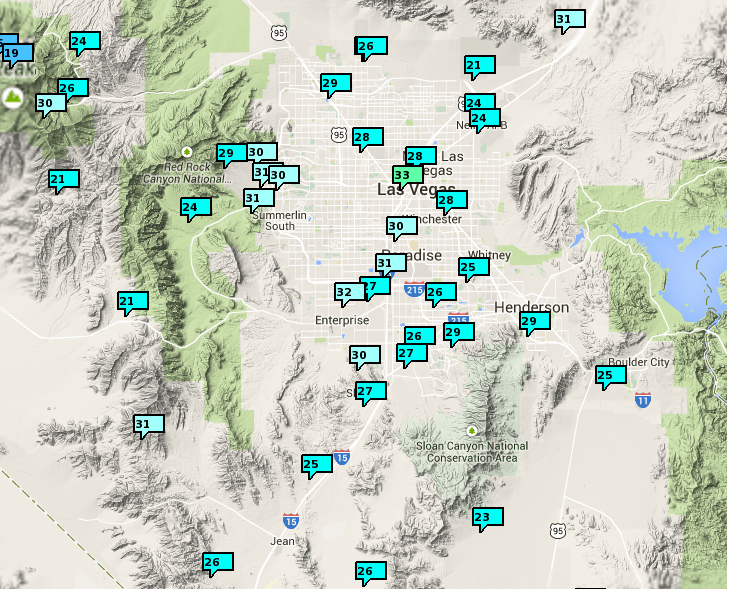
Credit: NWS
New Years Day snowfall is still on track with the NWS expecting upwards of 3″.

Credit: NWS
[s2If current_user_can(access_s2member_level1)]
GFS forecasted snow cover through 72 hrs.
Here were today’s highs. I believe those sub-zero’s over ND and MN are the first of the season.

Credit: weather.com
Tonight will be coldest of the season and tomorrow will see highs 20-35 below normal. Impressive given that it’s now the end of December when normal are indeed cold.
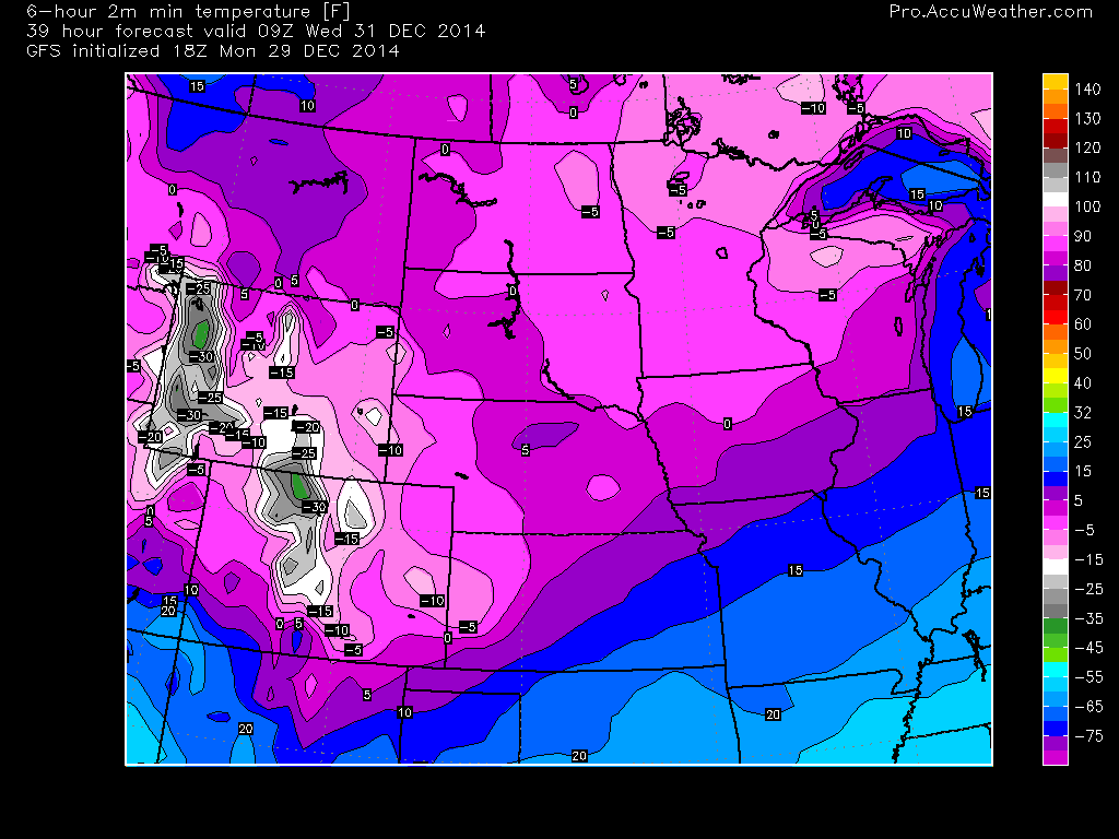
Tonight’s lows

Credit: weather.com
Tue Highs

Credit: weather.com
Departures from normal are widely 20-30 below normal.

After only barely getting above zero in Denver tomorrow, we may see a low close to -20 Wed AM while parts of Colorado and Wyoming’s High Country may see spots get close to -40.
More tomorrow.
[/s2If][s2If current_user_cannot(access_s2member_level1)][magicactionbox id=”18716″][/s2If]


")


Recent Comments