
Upwards of 7 INCHES of rain has fallen over the West Highlands since Friday evening and there’s little real easing over the next 24 hours.
[s2If current_user_can(access_s2member_level1)]
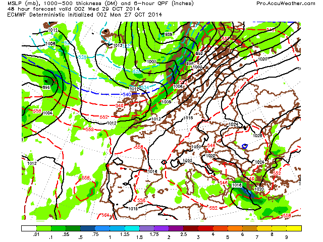
During tomorrow we see that stuck frontal boundary finally head south but not before rain increases in the very wettest areas later today. A very wet night and Wednesday ahead for the Central Lowlands, South of Scotland as well as Ireland and N England as the southward progress begins with a ‘drying’ out commencing later tomorrow from Oban northward. I am off to Oban today so I’m curious to see what kind of drive I’ll have later on this evening as the boundary taps further deep moisture with rain likely to pick up again. Looks troubling, given the amount of rain that’s fallen already.
When all is said and done, it wouldn’t surprise me of somewhere sees 9-10 inches before this front clears.
As you can see from the below charts, that front sinks south with rain intensity easing over central and southern parts. This opens the door to a feed of cooler air and so clear skies/light winds Wednesday morning heralds a frost potential for many across Scotland. Rural areas should widely dip to between +2 and -1C, locally -3 or -4C in sheltered Glens.

Credit: AccuWeather Pro
We catch a break through mid, even late week before the next Atlantic system pushes in during Friday and Saturday.

Credit: AccuWeather Pro

Credit: NCEP GFS
Credit: AccuWeather Pro

Credit: AccuWeather Pro
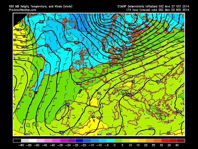
First Cold Blast Next Week?
Crummy looking weekend but look what follows NEXT WEEK? First COLD air mass…. Check out those 850mb temps…

Credit: AccuWeather Pro

Credit: AccuWeather Pro

Credit: AccuWeather Pro
Credit: AccuWeather Pro

Credit: AccuWeather Pro
See video for discussion…
OFFICIAL WINTER FORECAST 2014-15 WILL BE RELEASED THIS UPCOMING SATURDAY (NOVEMBER 1st).
[/s2If][s2If current_user_cannot(access_s2member_level1)][magicactionbox id=”18716″][/s2If]


")


Recent Comments