
The current trough which brought sub-freezing lows into Alabama and Georgia through the weekend will be lifting out over the next 36 hours, replaced by warmer but more unsettled weather once again.
The most noteworthy weather through the first half of this week will be the remnants of Simon which will come ashore on the Baja and then transfer it’s tropical moisture northeast into the Southwest and Southern Plains. Look for a soaking rain over Texas and Oklahoma late week and with a front coming down from the north, it looks like the late week into the weekend period may be quite the soaker for the Tennessee Valley and Appalachians. Yep more heavy rain for Arizona and New Mexico while this will be great for severe drought stricken Texas.
[s2If current_user_can(access_s2member_level1)]
I’m afraid California misses out with Simon’s moisture but just be patient as I’m confident your time will come given the warm water hugging the West Coast which we’ve not seen in recent years.
More ridging builds into the West this weekend and this is the response to the current typhoon recurve happening now over Japan.
Brought record rain and possibly wind too to Tokyo!
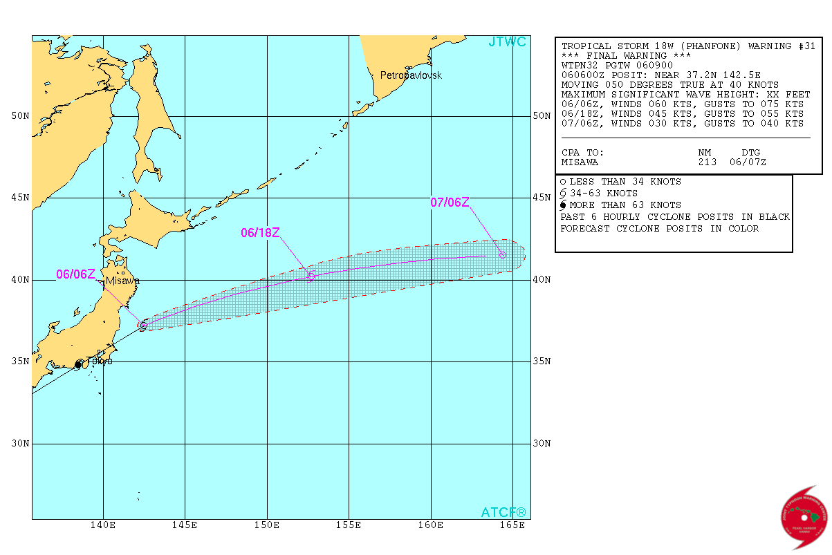
Credit: JTWC
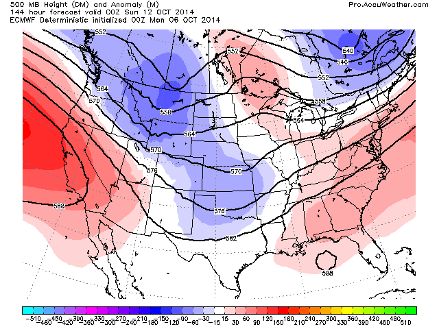
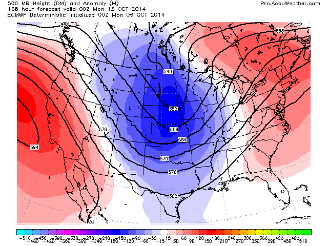
The next MAJOR TROUGH dives south into the Plains next week and while it get’s hot again in California with the return of 90s and 100s, we could be talking early snow and record cold over the Heartland. What’s going to be interesting is just how cold this next trough is as it drops further west and could be stronger with colder, possibly arctic air. Remember the NAO and AO is going strongly negative and with a NEGATIVE AO in particular, we’re talking a possible arctic discharge rather than Pacific like we saw this past weekend.
Be sure to watch the video just uploaded as I show you the surface chart and moisture associated with Simon but below I want to focus more on the upper air pattern and the next big trough coming south.
Hope to have more detail on potential numbers with the next cold shot and what follows this. Look for warm and wet in the East and with this next cold shot, expect warmth to hold on the EC.
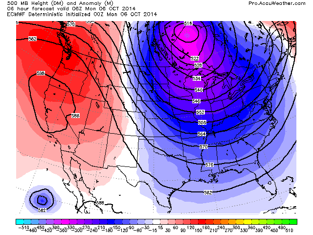
Credit: AccuWeather Pro

Credit: AccuWeather Pro

Credit: AccuWeather Pro
Credit: AccuWeather Pro
Credit: AccuWeather Pro
Ridge comes roaring back…

With combination of fronts driving south, warm, moist air lifting north and remnants of Simon, the Mississippi and Tennessee Valley will see the core of precip next 10 days.

See video for discussion!
[/s2If][s2If current_user_cannot(access_s2member_level1)][magicactionbox id=”18716″][/s2If]


")


Recent Comments