
As stated many a time now, I think fall is warmer than normal for much of the country but we may find a pool of cool in the Rockies, possibly extending eastward through the Plains where the troughs like to dig more. However, the warm water off the East Coast and stronger than normal Bermuda high means resistance for the western trough trying to push east.
[s2If current_user_can(access_s2member_level1)]
The next 10-20 days almost certainly looks PROGRESSIVE with plenty of west to east movement in the upper atmosphere. That means the warmth early this week which pushes into the Ohio Valley then east gets replaced by a cool trough but that cool trough is quickly replaced by another warm air mass. Look for these Pacific origin troughs which dives into the West to lift out from the Plains up through the Great Lakes and not so much into the Northeast thanks to the stronger West Atlantic high. While there will be spells of cool including this upcoming weekend from Nashville to New York, expect warmth to rule overall along with wetter than normal, especially over the Southeast.
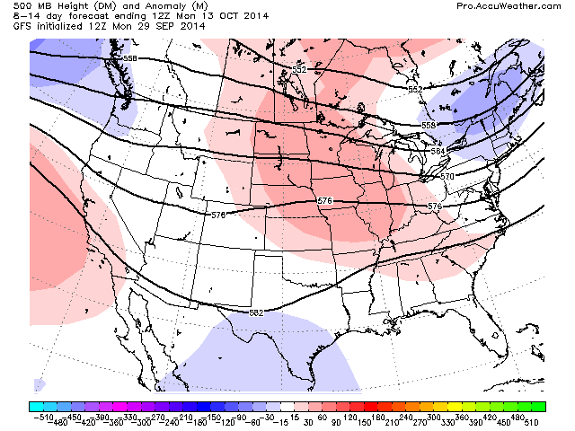
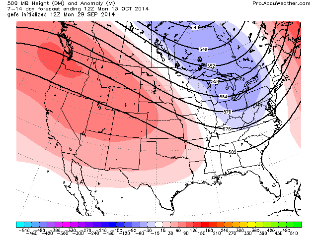
Week 1 (next 7 days) has the trough in the West sliding east but by week 2, both GFS operational and ensemble have warmth coming right back into the west which spreads freely across the country thanks to a predominantly zonal flow.
GFS

GFS Ens

Interestingly the ECMWF holds an EASTERN trough day 3-10.

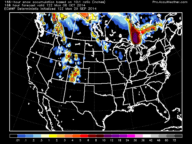
7 and 10 day precip amounts off the ECMWF.


Snow
Current scene from Monarch, CO.

With that ridge returning to the West Coast before sliding east, it’s going to get hot again throughout California.

Credit: NWS
[/s2If][s2If current_user_cannot(access_s2member_level1)][magicactionbox id=”18716″][/s2If]


")


Recent Comments