
The strongest upper ridge to date is now building into the Southwest US and will present the warmest temps so far.
Here’s how the upper air pattern looks over the US at 72 hours. Note while there’s the big Western ridge, there’s a deep trough and cold pool over the N Plains. This will hold daytime highs as much below average as the ridge will boost highs in the Southwest above average!
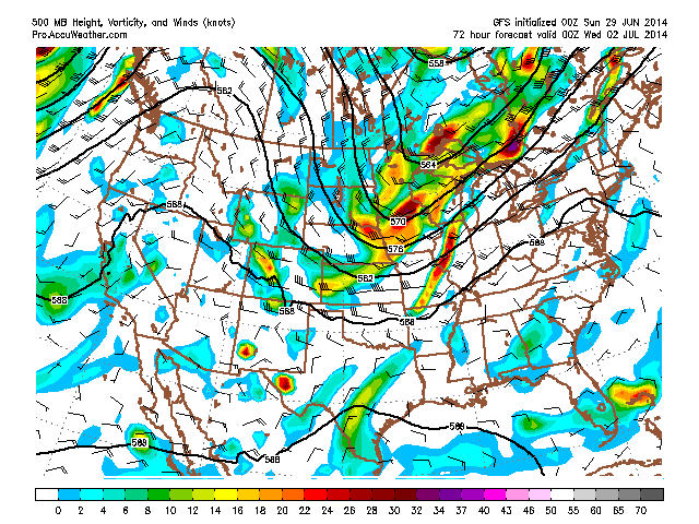
Courtesy/Owned by AccuWeather Pro
500mb height anomalies at 72 hrs

Courtesy/Owned by AccuWeather Pro
[s2If current_user_can(access_s2member_level1)]
That trough is actually being carved out by what is a very deep low crossing southern Canada. Pressure is seen by models to drop towards 980mb.

Courtesy/Owned by AccuWeather Pro
Also note the ball of very intense precip on the surface chart. Perhaps an MCS.
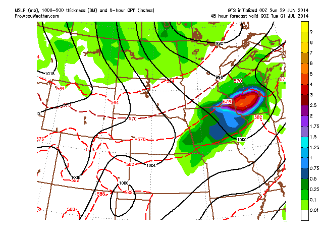
Courtesy/Owned by AccuWeather Pro
Of course we have the surge of heat and humidity up the East Coast in response to the western ridge/central trough. It will be a classic hot, humid run up to the July 4th holidays but remember, that central trough is heading eastbound and will bring a cool 4th of July.
Check out the shift in cool through this week.
96 hrs

Courtesy/Owned by AccuWeather Pro
120 hrs
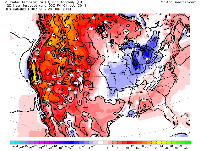
Courtesy/Owned by AccuWeather Pro
144 hrs

Courtesy/Owned by AccuWeather Pro

Courtesy/Owned by AccuWeather
While it’s typical heat and humidity up the East Coast, the focus of real summer heat will be Out West with widespread 90s, 100s with 110s in the Desert.
From the Western NWS offices.

Source: NWS Las Vegas

Source: NWS Sacramento
Tropics Beginning To Heat Up!
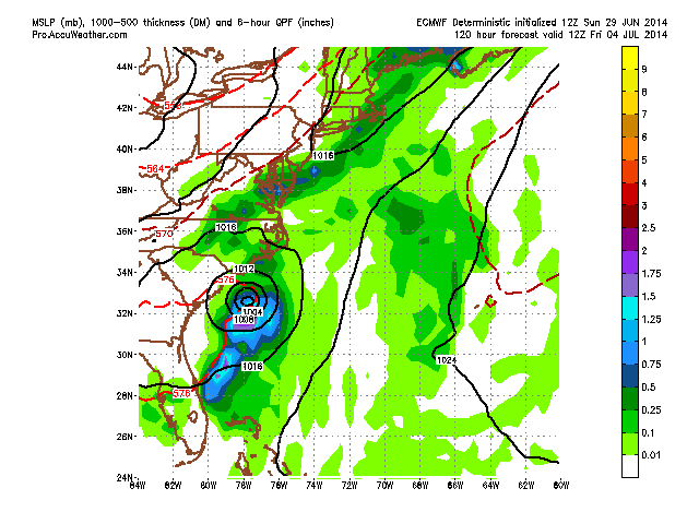
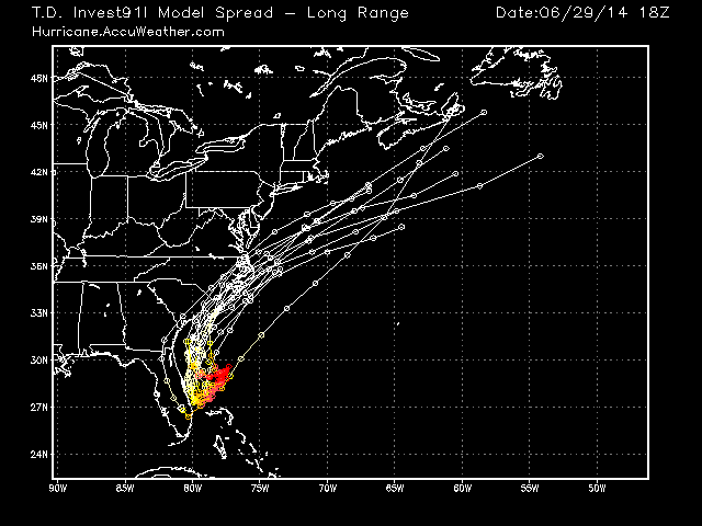
As for the tropics, we’re closely monitoring a system off South Carolina that the NHC now has a 40% chance of development within the next 5 days.
Latest infrared imagery.

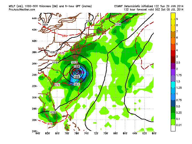
The ECMWF shows this system developing into a storm and even a hurricane while hugging the Carolina coast this upcoming week.
The water temperatures beneath the system are certainly warm enough.

Well above seasonal normal.

ECMWF surface charts.


Spaghetti chart
[/s2If][s2If current_user_cannot(access_s2member_level1)][magicactionbox id=”18716″][/s2If]


")


Recent Comments