
There’s lot’s of hype about a super El Nino coming on. We saw a strong westerly burst in recent weeks but there is reason to believe that the hype is unjustified. Since the super nino of 1997, every nino that’s came on ever since, has been weak and short lived, largely down to the cold PDO.
[s2If current_user_can(access_s2member_level1)]
Given the amount of cool water off and up against South America and the fact that the SOI value is RISING not falling, this Nino will come on and then fall during next winter, just like the others. Not all but many shouting the super nino are global warming promoters. The reason? Strong El Nino’s push up the global temperature.
Below are the latest SOI values which tanked and are now rising. That, according to Joe Bastardi of WeatherBell does NOT support a super nino. He also states that not only do you usually see longer, stronger El Ninos during warm PDO’s but also you typically have warm Pacific temps BEFORE a strong nino. Neither of which we have currently.
| Average for last 30 days | 5.6 |
|---|---|
| Average for last 90 days | -1.9 |
| Daily contribution to SOI calculation | 16.4 |
| January | 11.2 |
|---|---|
| February | -1.7 |
| March | -12.0 |
CFSv2 shows region 3.4 peaking moderate into autumn then comes the down trend during next winter.

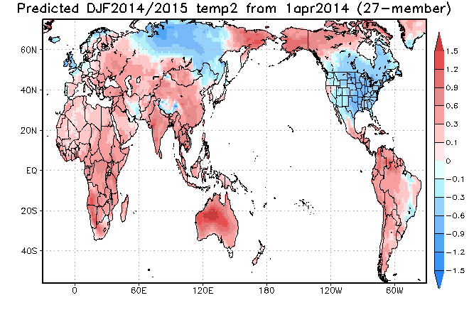
This chart shows the strong warming, then relaxation into next winter with warmest waters focused on the central Pacific with cool against the SA coast. That signals a cold US and Northwest Europe winter!

Jamstec peaks and then has a gradual fall.

Here was SST’s around this time back in 1997 as the super Nino was coming on. Look at the warm water throughout the equatorial Pacific and down off South America.

Look at the waters now! Note the cold off and against SA.
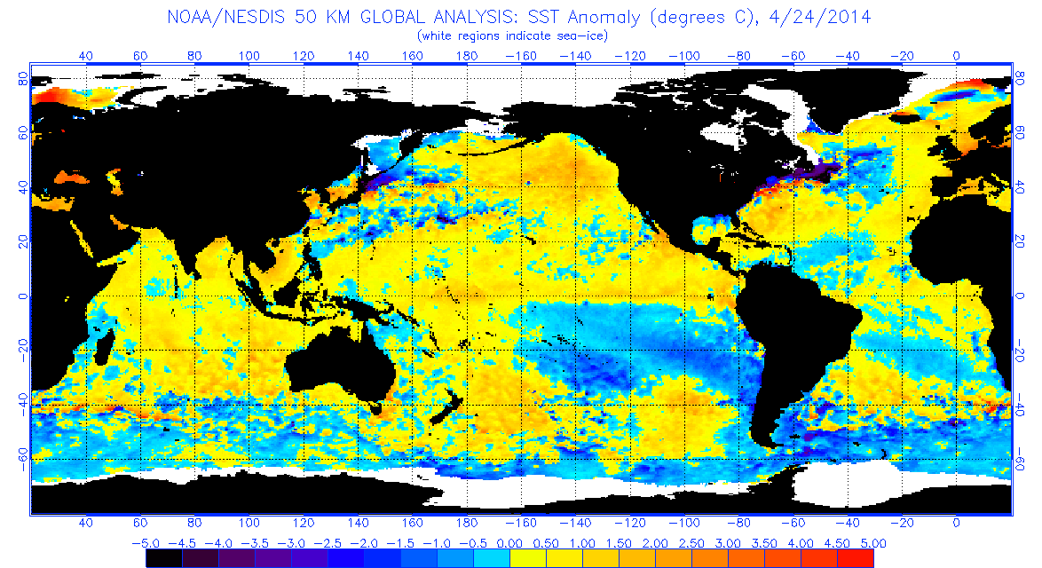
The fact the eastern Pacific from the equator southwards down the South America coast is cold, not warm, suggests this nino will be no different to all the others since 2000. A warm pool off SA would pump a ridge into North America and Western Europe during the winter but a central Pacific based Nino, like we should see this year into next, means more troughiness and cold.
Jamstec projected SST’s during summer.

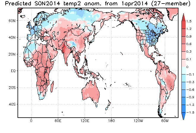
Next winter.

Note warmest waters are over the central Pacific.
Likely as part of the central Pacific based Nino, temps crash next autumn over North America and Western Europe with a cold look to winter. Similar to 2009-10 with more hemispheric cold rather than North America focused!
[/s2If][s2If current_user_cannot(access_s2member_level1)][magicactionbox id=”18716″][/s2If]


")


Recent Comments