
There’s good agreement with all the big models that a ‘Modoki’ style El Nino will form this summer. (Modoki: Central Pacific based El Nino, typical during cold PDO’s)
LINK: The El Niño Modoki

TOP IMAGE: Courtesy of NASA
[s2If current_user_can(access_s2member_level1)]
Due to the cold PDO, El Nino’s tend to be weak and short lived. Joe Bastardi of WeatherBell points out that these ninos tend to be atmospheric driven and surrounding cold waters quickly cool down the Nino 3.4 region fast forcing the collapse. Typically we see a spike in global temperatuyre as an El Nino comes on but particularly in short lived cold PDO El Ninos, there’s a tanking in the global temperature afterwards. The Jamstec model is seeing this.

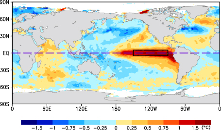
Here’s an SST example of a cold PDO (Modoki) style El Nino which leads to colder continents and is expected this year.

Warm PDO El Ninos which tends to warm the continents.
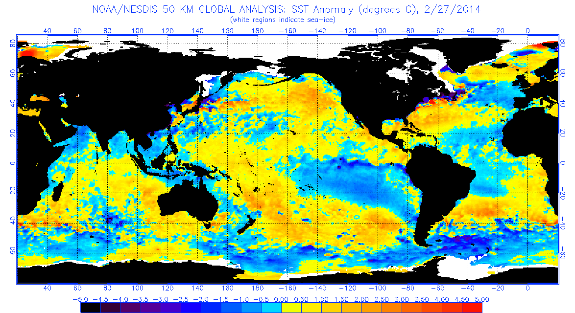
What’s interesting is that the Nino can be seen coming but it from an unusual west-east direction with warm waters spreading east from Asia towards the central Pacific. This can be clearly seen in the current SST anomaly chart.
But the real deal will be the warming up against the South American coast which quickly spreads west. Cold PDO El Ninos usually shift the warmth quickly west out into the central Pacific. El Ninos have more ‘warming’ influence on the continents when that water gets warmer and warmer and remains up against the SA coast but that is more typical during warm PDO’s.
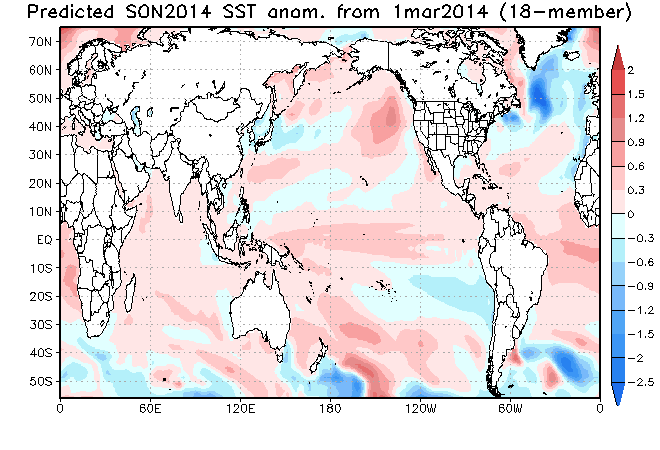
The Jamstec sees the onset of the El Nino, the quick shift out into the central Pacific and the weakening by the autumn.
Spring

Summer

Autumn.
Check out the temperatures in response.
Spring
Summer

Autumn

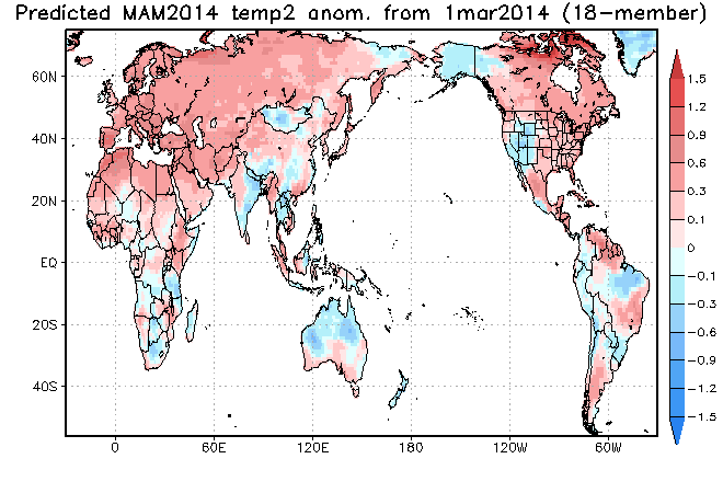
UK UPDATE: Due to COLD and not warm AMO look we have in the Atlantic and onset of the Nino this summer, we may and it’s a big ‘may’ at this time, have a better summer than originally expected here in the UK, especially the second half. Last year we had a terrific mid summer with dominant high pressure and heat. EVERYTHING depends upon the amount of precip we see over the next 6-10 weeks. Had waters been warm, it would likely have been a rather wet, gloomy summer. The new Jamstec shows the UK and Ireland warm now, notice that!
As for the United States, the warm water in the northeast Pacific is seen to persist which means that despite the onset of El Nino, Alaska will be warmer, drier while it’s cooler for much of the Lower 48, helped by the cold spring and likely colder than normal Hudson Bay and Great Lakes which will drive chilly winds into the Midwest and East well into summer perhaps.
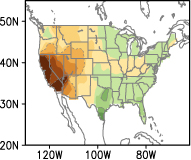
California Likely To Remain DRY!
Unfortunately, this El Nino doesn’t look like it will bring much relief to drought stricken California. It’s the wrong type of Nino. For significant rains to reach California, you want those nice warm waters in close to SA not out over the central Pacific.
TYPICAL (WARM PSO EL NINO)

MODOKI EL NINO (COLD PDO)
Typical temperatures during a Modoki El Nino.

Get ready for another cold winter next year America! We here in Europe could join you…
NOTE THE MAJOR COOL DOWN WHICH FOLLOWS INTO THE AUTUMN. EL NINO’S COLLAPSE CAN HAVE MAJOR COOLING IN COLD PDO’S AND NOTICE IT SHOWS THIS FOR BOTH NORTH AMERICA AND EUROPE.. AS JOE D’ALEO STATES, THIS HAS A MORE EASTERLY QBO LOOK FOR NEXT WEEK WHICH SUPPORTS A COLDER EUROPE AS WELL AS NORTH AMERICA! HINT HINT!
[/s2If][s2If current_user_cannot(access_s2member_level1)][magicactionbox id=”18716″][/s2If]


")


Recent Comments