
Old man winter continues to ignore the calendar and despite us now heading for the later stages of March, it appears SNOW expands once again across the North over the next 10 days. No surprise given the air mass coming down later next week. Just how cold? It could well be as severe as the air mass which dove south to start the month. In terms of departures from normal.
ECMWF snow forecast through 240 hrs
We’re talking a disruptive little swath of snow from Nebraska to the Lakes. A few inches expected in Minneapolis. Speaking of Minneapolis, we could be talking record cold highs and lows next week here as well as MANY other Midwest and Northeast cities.
48

Source/Credit: AccuWeather Pro
[s2If current_user_can(access_s2member_level1)]
120

Source/Credit: AccuWeather Pro
168
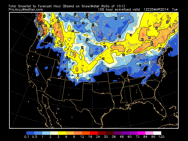
Source/Credit: AccuWeather Pro
240

Source/Credit: AccuWeather Pro
Notice the significant accumulation is has between day 7-10 over New England. Could see a deepening low which develops in the South, run up the coast and bomb out off the Cape just as the full hammer of cold comes crashing in.
Close up of that New England monster snow.
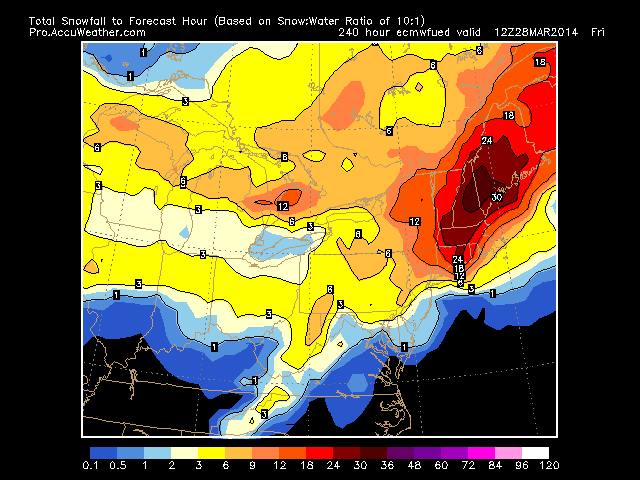
Source/Credit: AccuWeather Pro
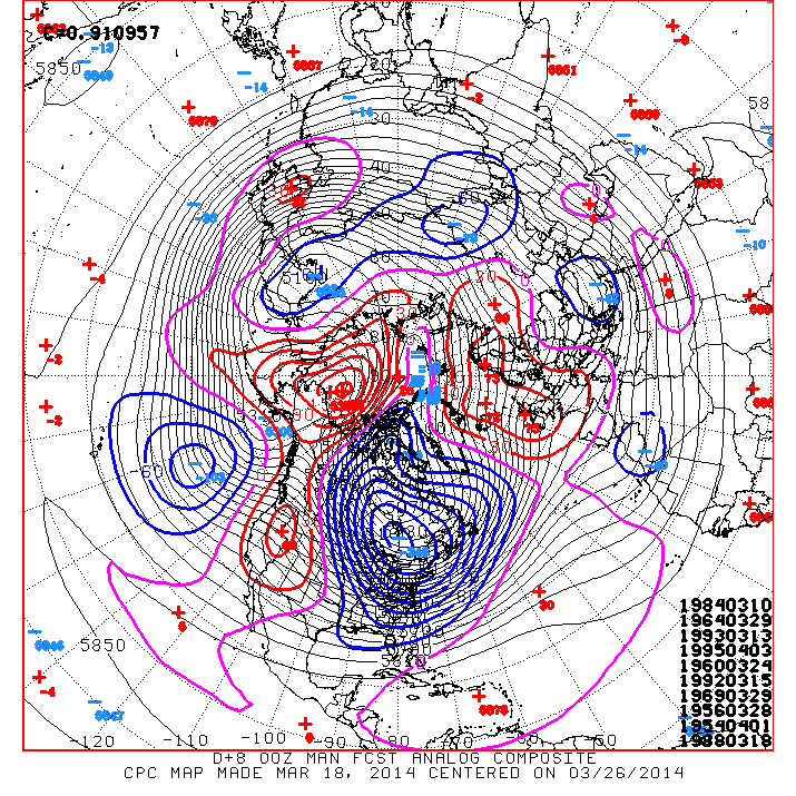
Here’s the CPC 10 day 500mb mean heights. That’s a COLD setup!
SPC 6-10 day temps.

Probably won’t escape even down in North Florida.
Here’s the ECMWF surface chart next week. Some remarkable thicknesses for this time of year. Note the 510 line reaches West Virginia and Western Maryland. Also note the bomb the model develops off New England, explains the huge snow totals projected above..

Source/Credit: AccuWeather Pro

Source/Credit: AccuWeather Pro

Source/Credit: AccuWeather Pro
By 204 hrs or next Thursday, the model shows the coastal low deepening to at least 964mb. If this happened, could have the potential to be a very noteworthy event for a region well use to blizzards and big snow totals.
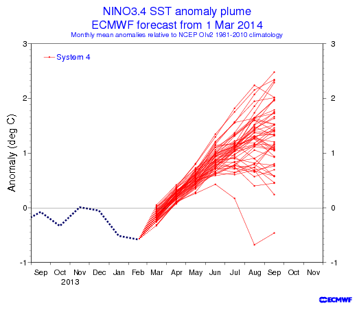
‘Modoki’ El Nino On The Way….
We continue to see the warming over the equatorial Pacific and along with model guidance, points to the onset on a potential weak Nino episode this summer.
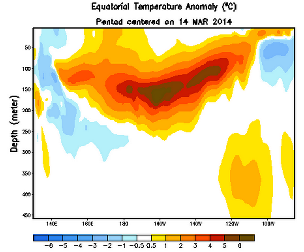
ECMWF very supportive of warming over the threshold of +0.5 degrees in NINO3.4
[/s2If][s2If current_user_cannot(access_s2member_level1)][magicactionbox id=”18716″][/s2If]


")


Recent Comments