>
Join The Conversation!
MV’s Long Range Discussion Now Available Scroll To Bottom!
Today’s Global Weather Headlines
US Latest
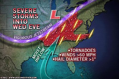
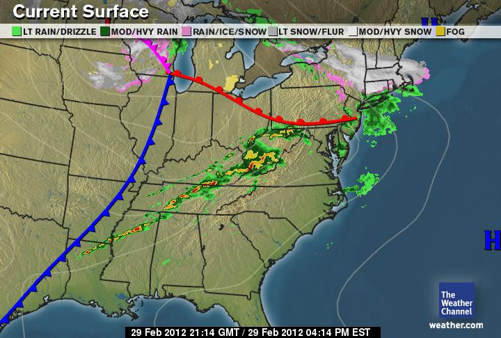
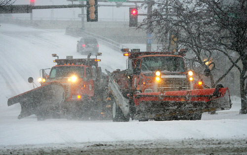
SPECIAL COVERAGE OF LEAP DAY STORM 2012
Biggest Storm Of Season Brings Deadly Tornadoes & Blizzards
Death Toll From The Severe Storms Is Now Up To 9
FOLLOW MY UPDATES ON FACEBOOK & TWITTER!

live feed…
– Preliminary reports from NWS show Harrisburg, IL tornado which killed 6 as an EF4 with est winds of 170 mph
– Flash flooding is being reported across Hwy 743, just east of Rhoda, KY
– 1″ hail reported in Relief, KY
– @henry_margusity says a possible tornado is heading towards Gallup, KY
– @weatherchannel reporting moderate snowfall in Boston area
– @WxMeghanEvans says IL Emergency Management Agency confirme 6 deaths in Harrisburg, IL
– Severe Storms barrelling across southern Missouri including the city of Branson
– The snow flakes are flying in Boston already says @EricFisherTWC
– Rotating storm moving into N. Estill, KY
– @henry_margusity reports of a supercell with history of producing tornadoes has been moving through Kentucky now for 4 hours, over 250 miles!
– Possibe tornado heading toward Hall, KY
LATEST STORIES
VIDEO: Storms Still Producing Tornadoes and Flooding
ACCUWEATHER.COM
7 killed as storm system slashes central U.S.
CNN
4 killed as tornadoes rake Midwest states
NBC NEWS
Tornadoes, Severe Storms Ripping Through Heartland
ACCUWEATHER.COM
Multiple Tornadoes Reported Across Heartland
THE WEATHER CHANNEL
Severe Storm, Tornado Threat Shifts East Today
ACCUWEATHER.COM

Latest U.S. Tornado Statistics (AWIPS ID:STAMTS*)
NATIONAL WEATHER SERVICE
The Cold Side Of This Storm…
Significant Snowstorm On Tap For Northeast Tonight Into Thursday!
While New York City sees nothing, Boston may see near a foot while Hartford, CT may get 6-8″!
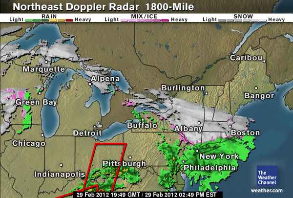
Upwards of 18 inches of snow is being reported across northern Wisc
Leap Day Blizzard for Pierre, Duluth Others
ACCUWEATHER.COM
Blizzard warning issued for Twin Ports; DTA cuts back routes
DULUTH NEWS TRIBUNE

Snow Albany to Boston This Afternoon into Thursday
ACCUWEATHER.COM
As latest forecast data comes in, no change to the New England snowfall accumulation forecast
MATTNOYES.NET

LATEST STORM ANALYSIS BY INNOVATION WEATHER
Severe Weather Statement–NATIONAL WEATHER SERVICE–TORNADO WARNING
Wednesday’s Edition of Innovation Weather for 2/29/2012–David Saurer
AMAZING YOUTUBE VIDEOS
Australia Latest
Huge Cloud Trail Stretching From The Northwest To Southeast Corner Is Bringing A Tremendous Rainstorm To A Huge Area
Europe Latest
Late Season Arctic Blast Looms For Much Of Europe, Turning Much Colder Across UK, Ireland
TODAY’S POST WILL CONTINUE TO BE UPDATED WITH THE VERY LATEST STORIES AND MORE THROUGHOUT TODAY, STAY TUNED!
THE EXTREMES OF THE DAY
TODAY’S US EXTREMES
COURTESY OF ACCUWEATHER
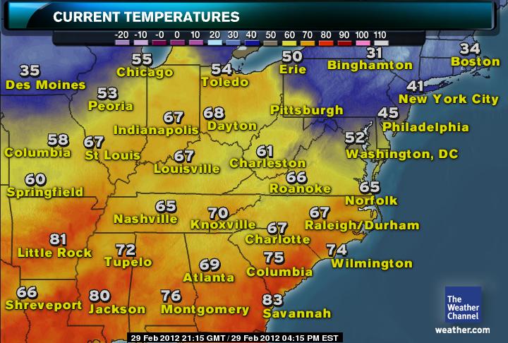
HIGH: 91° at McAllen, TX
LOW: -14° at Clayton Lake, ME
TODAY’S UK EXTREMES
COURTESY OF THE MET OFFICE
HIGH: 61° (16.3°C) at Hereford
LOW: 37° (2.7°C) at Fyvie Castle
TODAY’S EXTREMES HERE AT MY HOUSE
HIGH: 50°
LOW: 46°
Thanks for reading.
-Mark


Recent Comments