>FOLLOW THE BLOG ON FACEBOOK
TODAY’S TOP WEATHER STORIES
On Weather & Climate Through the Eyes of Mark Vogan
Police name two more earthquake victims, toll rises to 148
NZ HERALD
Christchurch earthquake: ‘This is no place to live any more’
NZ HERALD
Christchurch earthquake: Toll likely to top 200
NZ HERALD
IN OTHER NEWS TODAY
Major roads open after cold front drops snow, ice
LA TIMES
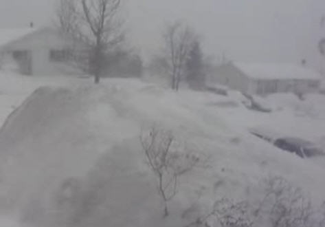
Snow Piles Up Across Newfoundland
THE WEATHER NETWORK
Maritimers Cleanup After Major Snowfall
THE WEATHER NETWORK
TODAY’S WEATHER ACROSS THE UK & EUROPE
By Mark Vogan
A return to more settled weather for UK as High Pressure settles in
As the United Kingdom enjoys more settled, brighter weather to start the workweek, days will be slightly cooler after pushing 13 to 15C late last week as we all loose that warm southwest flow and of course with higher pressure sitting overhead which brings lighter winds and clearer skies, we see a return to frosty nights and with a cooler base by morning, that means it’s likely daytime readings will fall short of those warm readings last week, however a higher angled, longer duartion of sunshine may do it’s work at warming us up nicely, particularly in shektered areas, but where a breeze lingers, it should remain off the 10C mark. We’re likely to see highs range between 10 or 12C in the south to between 5 or 6C in areas which tend to feel a cool breeze to 8 or 9C in sheltered areas in the north. What would you rather, cooler, though still relatively mild but sunny days or warm days but wet and windy dull conditions? I know what I would rather!
It’s interesting that despite a breeze today, when standing in the sunshine, you can really feel the warmth back in the sun as the shadows are really start to shrink as that sun climbs much higher in the sky. I’m noticing now that we still had daylight this evening till 6.45pm and on clear mornings daylight is creeping up by as early as 6.15am now. The late departure of daylight in the evenings and early arrival in the mornings combined with a higher angled late February sun, it is starting to make a difference in temperatures as that stronger sun is managing to heat up the surface and the feeling you get from the sun is noticable.
Eastern Europe returns to normal temperatures for the time of year, FINALLY! Significant low temperatures were recorded during the last 2 weeks…
After what has seemed weeks of bitter, Arctic cold, temperatures have moderated considerably after around 2 full weeks where Helsinki, Tallinn and Moscow as well as surrounding towns have fallen below 0 degrees F or -18C every night. Many cities of what has become frozen eastern Europe where a region stretching from far northern Sweden and Finland all the way to the Ukraine have endured persistent severe cold and periods of snow with temperatures well below even the levels of midwinter and actually recieving not only the coldest February temperatures in years but the coldest winter temperatures in years. For example, Tallinn, Estonia fell to a frigid -18F or -28C. This is not only the coldest temperature recorded since at least 1998 during the month of February but it’s the coldest reading for any of the winter months in at least 14 years. For Helsinki, Finland, the -20F or -29C low was the coldest February low in 12 years and the coldest temperature of any winter month in 8 years. In Riga, Latvia, the -15F or -26C reading here was the coldest February reading since at least 1998 but there was a lower reading of -18F not that long ago in January 2010. Stockholm, Sweden which fell to -13F tied a reading reached in February 2010 but there hasn’t been a lower reading during the month of February since way back in 1996 when a low of -14F was recorded.
TODAY’S WEATHER ACROSS AMERICA
From AccuWeather

Unusual Cold Expected For Oscars Red Carpet
By Bill Deger, Meteorologist
Significant Flood Threat For Ohio Valley, Northeast
By Meghan Evans, Meteorologist
Severe Storms, Tornadoes To Strike Plains, South Tonight
By Meghan Evans, Meteorologist
Texas, New Mexico High Fire Danger on Sunday
By Kristina Pydynowski, Senior Meteorologist

WEATHER TALK
By Mark Vogan
USA early in it’s first 100-degree high as Laredo, Texas soars to 103-degrees this afternoon
In 2010, it took until April 26 before America saw it’s first 100-degree high show up and that was at the well known California and national hotspot of Death Valley where it reached exactly 100.
This year, it’s early with today’s 103-degree high recorded Feb 27 at another well known Texas and national hot spot of Laredo located in the Rio Grande Valley and along the border with Mexico. Over the years of following US weather, I’ve come to believe that March appears to be the typical month which not only sees the arrival of 100s anywhere from California to Texas but also this month as well as April appear to be the months which sees the departure of below zero temperatures across the North. Between March and April and only on a few occations such as last spring do we see subzero lows occur into May!

WHAT’S REACHING TODAY’S BLOGS?
Severe Weather the Big Story Today
Henry Margusity, AccuWeather
9th Snowiest Winter on Record (more snow forecast for Thursday)
Paul Douglas Weather Column (Weather Nation Founder)
Freezing Rain Warning
Valley Weather (Montreal, QC Area)
THE EXTREMES OF THE DAY
TODAY’S US EXTREMES
COURTESY OF ACCUWEATHER
HIGH: 103 degrees at Laredo, TX
LOW: -19 degrees at Clayton Lake, ME
TODAY’S EXTREMES HERE AT MY HOUSE
HIGH: 50 degrees
LOW: 29 degrees
TODAY’S CONDITION’S (LOCALLY)
After an overnight which started clear and allowed the temperature to fall to 29 degrees, clouds, rain and breezier conditions rolled in overnight and presented the early morning with a wet, dreary start. However, things cleared nicely by mid to late morning and presented the afternoon and evening with fine, clear and sunny skies and in that sun, it felt pleasant. Clear skies leading into tonight will bring back to potential for a frosty overnight.
Thanks for reading.
-Mark


")


Recent Comments