>Today’s Top Weather Stories
On Weather & Climate Through the Eyes of Mark Vogan
WHY SO MUCH SNOW AND COMPARED TO LAST WINTER?
Time of Year
When this cold air arrived, it did so at an unusual time of year. For sure, it’s not unusual to see snow and or cold by November 20th, however the MAGNITUDE and INTENSITY of this cold was comparable to last year’s coldest 5-7 day period over the Highlands and once those snows pushed out of the Aberdeen to Edinburgh and across to Glasgow corridor, temperatures either matched the coldest experienced all of last winter or incredibly succeded those numbers. The most severe cold arrived around January 8th with a low of -22C at Altnaharra, -10 to -12C in the Glasgow to Edinburgh corridor, -14C down at Eskdalemuir in Dumfries and Galloway and -18C at both Woodford (Greater Manchester) as well as Benson, Oxfordshire.
Remember, those numbers not only were achieved in the heart of winter, the typically coldest period of winter with lowest angeled snowlight but snow covered practically all of west and central Europe as well as the UK. It was a vast and powerful Arctic outbreak and indeed there was lows of record or near record levels with near record coverage of snow over Europe during the final 10 days of December.
The power of this air mass was more impressive because it was still very early for the severity of the cold we’ve experienced.
The intensity of the Arctic air mass
In my opinion, this year’s cold, though has seen less “frigid days” for the population centers of Britain with sustained days below freezing (0C) and night’s plummeting into the -6 to -10C (so far) as compared with last year has however seen more or at least as impressive numbers. For England, the -17.9C recorded at Leeming, Yorkshire is as impressive as Woodford and Benson’s -18C last year. For the Highlands there have been three consecutive morning’s this year with a low at or below -20C, this didn’t occur last year though there was repeated -15 to -18C lows over the Highlands throughout the last 10 days of December and first 10 days of January which actually brought apparently the coldest winter in recorded history for the Highlands of Scotland… What I found very facinating was that Braemar, Aberdeenshire saw “offically” a colder reading with it’s recently -20.1C reading, that’s colder than last year but of course the -19C reading was recorded as late as March and December of last year was -18C, the coldest in the UK for that month.
Altnaharra in between recording lows of -20 to -21C on two morning’s running saw a downright frigid high, if you can call it a high, of -14C, two degrees colder than Britain’s coldest high last year!
High’s position
One of the biggest and most explanitory reasons for why there has been such vast and persistent snows covering much of the Highlands from Caithness to Badenoch and Strathspey across to Aberdeen, down into Dundee, Perth, Edinburgh and down to Selkirk, Jedburgh and into Northumberland, Durham and Yorkshire has been because not only has the power and coverage of this air mass been much stronger than typical for this early stage in winter but it’s core has been further north than the “core” of the air mass last winter which more or less parked over us. It’s clockwise winds circling the high has been blowing bitter winds out of the NE, across the still warm waters of the North Sea and with these winds picking up the moisture off the sea and winds and air in place over Britain so cold, all the moisture has fallen as heavy snow. The stuck nature of the core to the north of the UK has meant persistent winds funnelling in and without movement of the core, nothing changes and thus this is why we saw such heavy snow. Had this very air mass been a month later, we wouldn’t have seen near as much snow into Edinburgh and north and south simply because the North Sea would have cooled more and this been less conducive for these winds to pick up the moisture. Extremely cold air blowing across a relatively warm and of course I use the word “relative”, this is exactly like lake-effect snowfall that occurs in the Great Lakes of North America! Call it sea-effect.
That also explains why there was less snow last year and it arrived on the leading edge of the very cold air mass of last year. The snows arrived uniformly between Dec 18 through 24th, blanketed the UK and then Arctic high pressure arrived and parked itself over us. Less wind, colder days and night and because it was a generally stable air mass directly overhead, this put a lid of snowfall! This year, whilst the far north saw the conditions the Central Belt saw last year with persistent, yet very cold days and nights under almost non-stop sunshine, further south (south of Inverness) winds have consistently been blowing off the North Sea and snow showers have been on a non-stop train for pretty much a week.
The Glasgow area saw plenty of snow thanks to the geography of the Central Lowlands. The Forth Valley acts like a tunnel with the southern uplands to the south and highlands to the north, that’s why heavy snows were extended into the western central belt, though much of the heaviest snow pettered out the further west those showers went!
Why has the worst of the snow been over the east?
Like downwind areas of the Great Lakes that are either right on the shore or slightly inland but slightly higher in elevation will recieve the most snow.
One must remember that Arctic air masses are generally moisture starved. Run bitterly cold air over top a warm body of water and this produces convective clouds and thus if that air is cold enough, it will simply snow rather than rain. In this instant, those winds were what I would call abnormally cold for the time of year. It was for sure, an air mass comparable to last year, but too early so to speak and we all know how cold that air mass was and that was during the mid-point of winter, when these air masses when they do arrive, would arrive!
It was kinda like the perfect storm for east coast folks where tremendous snowfall and depths which all but crippled cities like Aberdeen, Dundee, Perth and down to Edinburgh and Newcastle. The Grampians and Cairngorms saw the largest snowfalls simplky because their mountains and as these cold winds hit those mountains, they upslope and as they climb up the windward face of these mountains, the air cools further, condenses and thus heavier snows are created.
Why has much of Ayrshire & Dumfries and Galloway hardly seen snow?
The nature of this set up is one which for a start, is moisture starved as explained above and thus the moisture available has a limit compaired with an arctic air mass that has warmer, Atlantic air to work with and has much higher amounts of moisture available. Tropical or sub-tropical air holds much much higher moisture capacity and thus last winter when snows became widespread and places like Dumfries and Galloway recieved just as much snow as areas in the east, thus was because there was Atlantic air which drove into colder air already over the UK and thus heavy snows hit ALL areas. This time around, like a lake-effect event, there is limited moisture available and only those winds blowing across warmer North Sea waters can pick up moisture, there’s not really any moisture available within the actual air mass, thus as winds blow from NE to SW, will those winds deliver to snow until it literally runs out of moisture. As you’ll have gathered, hilly areas as well as places nearest to the North Sea coast recieved the highest snow totals. Once the clouds hit the father west and southwest hills away from the North Sea and once they’d crosses the heart of the Highlands, there was literally just whisps of cloud and no moisture! That is why Ayrshire, Dumfries and Galloway and other areas further west didn’t recieve much, if any snow.
Today’s Weather across America
From AccuWeather
Big Upcoming Snowstorm for the East?
By Meghan Evans, Meteorologist
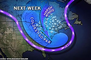
Harsh Winds Howl Across the Great Lakes, Northeast
By Meghan Evans, Meteorologist
Near Blizzard Set to Pound Maine, Quebec
By Bill Deger, Meteorologist
New York City Drops to Freezing for First Time Since March
By Meghan Evans, Meteorologist
What’s Reaching Today’s Blogs?
Frigid To Start, Possible Snowstorm Next Weekend
Frank Strait, AccuWeather
The Extremes of the Day
Today’s US Extremes
Courtesy of AccuWeather
High: 80 degrees at West Palm Beach, FL
Low: -15 degrees at Conrad, MT
Today’s UK Extremes
Courtesy of the Met Office
High: 46 degrees (7.7C) at Chivenor (Devon)
Cold High: 27 degrees (-3C) at Carlisle (Cumbria)
Low: 9 degrees (-12.6C) at Topcliffe (North Yorkshire)
Today’s Extremes here at my house
High: 30 degrees
Low: 19 degrees
TODAY’S CONDITIONS
Snowcover: 7 inches
AFTER A COLD, BRIGHT START, THE DAY REMAINED A PICTURE-PERFECT WINTER’S DAY WITH UNLIMITED SUNSHINE AND FEELING PLEASANT WITHOUT ANY WIND AND AND LOT’S OF SUN. THIS LEAD TO A VERY COLD NIGHT WITH EVEN 6PM READINGS JUST OUTSIDE OF MY TOWN REGISTERING -11C (12 DEGREES) IN THE CAR!
Thanks for reading.
-Mark


")


Recent Comments