>NEW: USA WINTER FORECAST IS NOW AVAILABLE AND CAN BE FOUND BELOW UK FORECAST RIGHT HERE!
See Weather & Climate Through the Eyes of Mark Vogan on Facebook and Twitter. What are you missing? Videos, Weather Info and promotional items which are NOT seen here on the blog! During your visit, click “like” and be a part of the blog.. thanks for reading and your support.
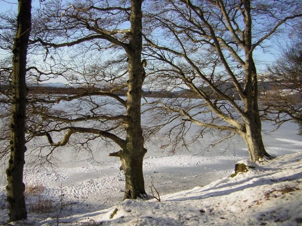
Mark Vogan’s Official 2010-2011 Winter Forecast for Great Britain and Europe
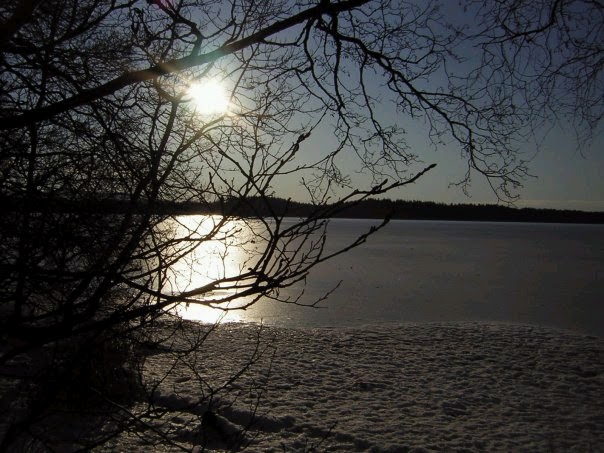
Britain to face a 3rd straight winter with significant periods of cold and snow, however worst of winter will hang over central and eastern Europe, making this year different to last.
KEY HIGHLIGHTS
Like experienced during the winter 2008-09 there will be a series of cold waves brought in from the Arctic presenting much of the UK with snow and low temperatures. With perhaps several cold waves this year, these blasts of Arctic air will likely last 5-10 days on average throughout the winter season (December through March) with milder Atlantic air filtering back in between each cold period.
The November 20th through December 31st period may turn out to be the worst part of winter, with a set up eerily similar to the closing days of December 1995 which brought a low of -20C to Glasgow and a tie of the UK record of -27C at Altnaharra, Sutherland!
Coldest air of winter to settle over Western Europe, including UK during first half of season, then migrate eastwards as the season progresses allowing mild Atlantic air to rule for the mid-point of winter.
Much of December may be much below normal from Inverness all the way to the south coast of England with daytime highs struggling to get above freezing. Nights, if there’s plenty of snowcover, may see temperatures plunge below -10C across much of Britain away from the coast with some of the coldest spots in England (Shap, Cumbria, Woodford, Manchester, Benson, Oxfordshire) pushing into the -15 to -18C range and some Scottish Highland locales such as Dalwhinnie, Tulloch Bridge, Tyndrum, Aviemore, Altnaharra and Braemar may take a run at the values experienced last winter (-18 to -22C).
All of the major Scottish cities of Glasgow, Edinburgh, Perth, Dundee and Inverness may see highs only warm to -3 or -4C with night time lows plummeting under the perfect conditions of an already very cold air mass, clear skies, light winds, an Arctic high pressure cell overhead along with widespread snowcover which will allow maximum radiational cooling and may drive night time lows into the -11 to -15C range in these cities. Major towns such as Stirling, Livingston, East Kilbride, Airdrie to name just a few, may see days struggle to also reach -3 or -4C. With the same conditions in less urban-warmed environments of towns and plenty of snow covering the ground to help trap heat being released by the soils below, nights may plunge to near record values, dipping towards -15C. Yes even in town and city centres.
The major cities of northern and central England and Wales may also be in for a cruel blast from the Arctic, though snow should cover many places, temperatures in towns and cities that are away from the moderating influences of both the North Sea and Irish Sea and have snow on the ground may take a run at -8 to -10C. Liverpool may shiver to -7C whilst further inland Manchester, just west of the Pennines may see lows push -10 to -12C whilst Woodford which hit a frigid -18C last year may push -15C, given last year’s value was extreme!
I expect Birmingham to drop towards -8 to -10C and similar values for Oxford. London may be in for colder than anything experienced even during the cold of winter 2008-09. Whilst the lowest values at Heathrow were -6C, a -7C or perhaps even a -8C is possible this year!
After a fairly tough December overall and a high probability for a White Christmas across much of interior Scotland including the Central Belt of Scotland (Glasgow to Edinburgh and points north and south that are away from the coast) as well as many areas of interior northern and central England including the Midlands, but snow may stretch as far south as Oxford and outlying areas of Greater London and interior Wales, (Northern Ireland may not see much snow) a major mild period is likely to hit as all the cold Arctic air commences it’s migration eastwards towards the heart of central and eastern Europe from Germany and Poland southward to Switzerland, Italy and across to the eastern European countries of the Ukraine, Romania and Turkey, this will be their turn to experience a brutal mid and later part of winter 2010-11. I expect this transition from very cold and snowy to very mild and perhaps wet and stormy for the UK and western Europe close to or slightly after New Year and may stretch through much of January. The heart of winter from January 1st through February 1st may see a harsh and severe winter period set in with Moscow perhaps enduring one of it’s worst deep freezes in living memory, many central and eastern European countries are likely to see some of the coldest temperatures in 50 to 100 years along with many deaths.
After the milder period, on and off, less intense cold and snow will impact through February and March.
A LITTLE INSIGHT INTO MARK’S THOUGHTS
SPRING AND SUMMER PATTERN TELLING A STORY
After periods of record-breaking cold which have shivered the UK, outwith the more typical cold season with last May displaying the coldest values since 1996, August being the coldest in 17 years with a frosty close to what’s typically a summer-month and both September and October showing yet more unusual cold for the time of year. Though I don’t see this as a sign of a truly brutal winter ahead, I do see this telling me other things about the winter ahead for us Brits and indeed across the continent.
UPCOMING WINTER MAY HAVE MORE IN COMMON WITH WINTER 2008-09 THAN LAST YEAR
Winter 2008-2009 was a cold winter when comparing the previous ones with repeated cold and snowy periods. Remember the snow that crippled London in February, all in all it was colder and snowier than anything seen since 2000-2001 and MUCH colder than those warm, wet and wind-ridden ones leading up to 08-09. But despite 2008-09 displaying some of the coldest temperatures in many years and plenty of snowy periods, there was milder weather in between, including a mild period which shattered our chances of a White Christmas after the coldest start to a December in some 30 years.
Last winter of course was near impossible to not have that White Christmas with picture-perfect scenes and too much cold, across pretty much all of western and central Europe….
So, why not the same kind of winter to last? That question is simple, there are different drivers or players on the field, that will alter the tactics as to how and where Old Man Winter will fire the shots.
Instead of an El Nino last year, we have a La Nina, this tends to set up the upper-atmospheric pattern differently to an El Nino, thus explaining first and foremost why I think this year will be different. La Ninas don’t tend to favour as much cold to “western” Europe as much as El Nino, however, always remember that no El Nino or La Nina is created equal or the same, therefore that is just the start of the complications to this year’s forecast.
A BLOCKING PATTERN OVER THE NORTHERN HEMISPHERE CREATES THE EXTREMES WITHIN THE FORECAST
Over the past 6-12 months now, perhaps due to increased high-latitude volcanic activity or not, the pattern across the Northern World has very much been dominated by a “blocking pattern”, large ridges and troughs that sit in one place for weeks, if not months, that’s what we’ve seen this summer with the warm, dry settled pattern to start. But then as summer matured that ridge migrated eastwards, and our atmosphere was replaced by a trough, bringing the mid and later part of our summer unsettled and generally cool weather, yet 1,000 miles to the east, it was the hottest summer on record in Russia and surrounding countries.
Last winter the “stuck pattern” brought a dominated Arctic “Continental” pattern of very low temperatures and periods of snow, combining the snow cover, persistency in the cold air to keep the snow from melting as well as what I would call the “classic El Nino” winter trough over western Europe as well as the shear depth of Arctic air which was contained within that huge trough, that is what brought us very cold temperatures, persistently from late December through late March and all the way into May.
ULTIMATELY WINTER 2010-2011 TO SEE LESS PERSISTENCY IN THE COLD COMPARED TO LAST YEAR BUT WHEN THE COLD AND SNOW DOES HIT, IT MAY BE WORSE THAN LAST YEAR IN AREAS!!
I have fought and fought with my ideas right up till now (Oct 29th) about just how cold and snowy the periods will be this year.
Although the La Nina pattern as it sets in this year, particularly into the later half of the winter would suggest the Arctic trough to be bias towards eastern Europe, there is part of me, that’s not wanting to suggest that we’re in for a warm mid to later part of winter.
Other factors……
LOW SOLAR CYCLE PLAYING A ROLE IN A COLD FORECAST
Whilst there will be a substantial mild period in between cold for the UK, this forecast, like last years is colder than what many have out. So why am I forecasting for extreme cold again?
My reasoning for the cold to be as severe as I believe it will be is because of the continued “very low solar cycle” and this also played a major deciding factor into last year’s forecast. There has been little pick-up of activity on the face of the sun. The more sun spots there are, the more active it becomes. Though there has been more spots appearing over recent months when compared to this time last year, it remains very quiet and this worries me about the effect this may directly have on our winter again here. By looking at history, the activity on the sun and it’s relationship to temperatures here on earth relate hand in hand and this coupled with an increase in high-latitude or Arctic volcanic activity and their impact on cooling as well as more importantly “high latitude blocking” means that though the pattern of the upper-levels is different and would likely suggest milder rather than colder, there are outside factors that I believe can’t be ignored.
Feel free to add your comments or email me regarding this forecast.
NEW!
Mark Vogan’s Official 2010-2011 US Winter Forecast
After an easier, less snowy and cold winter across the N. Plains and Midwest and a tough, cold and record snowy winter from north Texas to Washington DC, it will be the opposite this year
A flip of extremes will be the script for the show this winter season across the US lower 48. Alaska looks to be in for the worst of winter this year when looking at the whole of North America, after getting off lightly last year. In fact folks living in the 49th state may well endure a harsher winter than anything endured in many a year with expectations high of plenty of early season snow which will set the stage for possibly a record challenging 2-month stretch where the interior frequently hits -70 or lower temperatures. Fairbanks may be in for it’s first -50 or lower temperature in many years. If you think that this winter will be a complete upside down of last year, your spot on.
SOUTH AND MID-ATLANTIC’S COLD AND SNOWY WINTER OF 09-10
AN UNUSUAL PLACE TO FIND UNUSUAL RECORD COLD AS WELL AS RECORD SNOW
Where it was cold and indeed snowy, it was also both found in a rare part of the continent and was done in record breaking style with sections of Florida shivering in it’s coldest winter on record and Dallas being a fraction away from it’s snowiest winter on record.
For both cold and snow, a path streatching from Dallas, across the Deep South, up into the Mid-Atlantic states and the southern stretch of the I-95 corridor was where winter was worst last year. In contrast it was relatively tame with a milder and less snowy winter across the central West, Pacific Northwest, Northern Plains and Great Lakes as well as New England. The areas which should be milder weren’t and the places that should be harsher were milder.
AREAS THAT GOT OFF LIGHT LAST YEAR ARE IN FOR WINTER’S PAYBACK, THOSE WHO SUFFERED WILL FIND RELIEF
For those stretching from Southern California to Georgia who hate cold, rain, cloud, snow or winter in general and suffered last year, thinking they’d moved to a place which shouldn’t have the weather they did, well this year should be a return to the “norm” or even better!.
EACH 500-MILE STRETCH YOU HEAD DIRECTLY NORTHWEST OF INDIANAPOLIS, WINTER’S PUNCH WILL BE MORE SEVERE WITH THE CORE OF WINTER CENTERED OVER EAST-CENTRAL ALASKA AND THE YUKON!
My quote as unusual and as wierd as it may be is my “catchphrase” if you will this year. I believe the worst of winter will stretch from the epicenter of cold which will be the eastern interior of Alaska and the Yukon of Canada and will stretch in a near perfect southeast line, slicing through North America’s core and across Chicago and into Indianapolis. Fingers of cold will reach both westwards into the Pacific Northwest and eastwards into the Northeast, presenting colder weather than anything seen last year. Icestorms may effect the Central Plains, in a line stretching from Garden City, Kansas through Kansas City, St Louis to Lexington, Kentucky. That means Oklahoma City to Dallas and across to Atlanta and the Carolinas may find very little in the way of snowstorms or even snow showers this winter (though they’re not likely to see NO snow!).
PACIFIC STORM TRAIN LIFTS NORTH THIS WINTER
Whilst frequent Pacific energy punches into an active southbound Arctic air flow bringing a couple of sizable snowstorms to the Cascades, Rockies and the Plains, Alberta clippers will also be sent to present each and every fresh wave of Arctic air from the pole into the Northern Plains and Great Lakes. South of this year’s “Icestorm Corridor”, mentioned above, it should be mostly sunny with milder than normal temperatures which at times may creep their way out of the Wichita Falls (Texas) to Wilmington (North Carolina) corridor and push 60s or even 70s up towards and through DC, Baltimore and Philadelphia during mid-winter as the “Southeast La Nina ridge” fluctuations in size throughout the season.
Though the Northeast region from Trenton, New Jersey up through Boston to Caribou, Maine may on the whole average out near normal, there is a high probability of one if not two periods where the Arctic air which slams into the Great Lakes may get all the way across to the East Coast and suppress the La Nina ridge, bringing very cold weather for a time throughout much of the nations Midsection and Northeast. Whilst temperatures got down to a respectable 6-degree in DC and Baltimore as well as New York during the cold wave of 2008-2009, last winter only saw lows drop down into the low 10s. This year may see lows more comparable to 2008-09!
As for the Pacific Northwest, this is likely to be a bumper snow year with potential for record snows in the Olympics of Washington and the Cascades as well as over the Northern and Central Rockies and Blackhills of South Dakota as the storm track this year shifts further north than last year. This shift is thanks to the La Nina rather than El Nino,. La Nina typically sends the storm track into the Pacific Northwest and the El Nino sends the storm track further south and into central and southern California. No southern storm track across this region means sunshine and warmth, the opposite to last winter.
A WARM TO AT TIMES HOT WINTER AHEAD FOR SOUTHERN CALIFORNIA, 90s, EVEN 100s MAY BE EXPERIENCED
I wouldn’t be surpised if we didn’t see a few Santa Ana wind episodes which would not only raise the fire risk as the winter precipitation over the region will be easily below, if not well below normal but with the further drying created by the winds which typically blow out of the northeast, this means HEAT! I recall winter of 2002-2003 when big snows occured over the Pacific Northwest and a warm, dry winter occured over Southern California. A strong Santa Ana wind event took place, creating not only major fires but also sent January temperatures into the 90s and there was a 100 degree reading found at Anaheim, yes in January!. This may occur in winter 2010-11.
The Extremes of the Day
Today’s US Extremes
Courtesy of AccuWeather
High: 95 degrees at San Angelo, TX
Low: 15 degrees at Embarrass, MN
Today’s UK Extremes
Courtesy of the Met Office
High: 59 degrees at Isles of Scilly
Low: 34 degrees at Aboyne
Today’s Extremes here at my house
High: 49 degrees
Low: 41 degrees
Thanks for reading.
-Mark


>Agreed This was a MOST excellent forecast, clearly explained, in terminology we can all understand my hat goes off to you sir, and I really hope this comes to fruition, I'm eagerly awaiting some nice snowy weather here in Brighton UK, so I can take my dogs out again at 4am in the fresh snow before everyone else get's to play in it..he he
>Great forecast,and superb in depth study. Region wise forecast, with city expected temperatures for the U.K. is great.
Mark, there is no question of waiting to see the outcome. People have to make a note of this and prepare themselves for the winter.
Well done Mark !!