>SEE NOTE AT BOTTOM: Internet Connection Problems
See Weather & Climate Through the Eyes of Mark Vogan on Facebook and Twitter. What are you missing? Videos, Weather Info and promotional items which are NOT seen here on the blog! During your visit, click “like” and be a part of the blog.. thanks for reading and your support.
Less Than 24 hours to Go!
MARK VOGAN’S OFFICIAL 2010-2011 UNITED KINGDOM AND EUROPE WINTER FORECAST.. are you ready?
Today’s Top Weather Stories
On Weather & Climate Through the Eyes of Mark Vogan

Image Courtesy of CNN
New volcanic eruption sends Indonesians fleeing
CNN
Merapi Volcano and the Winter Outlook
AccuWeather News
Hurricane Tomas Closes Airports, Damages Buildings in St. Lucia
AccuWeather News
Russian Volcanoes Cease Spewing Ash
AccuWeather News
Chaba Departs Japan as More Heavy Rain Arrives
AccuWeather News

Today’s Weather across America
From AccuWeather
Boulder Residents Evacuated for Wildfire Threat to Return Home
By Vickie Frantz, AccuWeather.com Staff Writer
Dry, Warm Southeast Winter will Worsen Drought
By Gina Cherundolo, AccuWeather.com Staff Writer
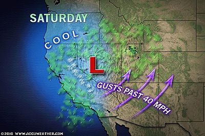
Damp, Dreary Weekend Day in the West
By Katie Storbeck, Meteorologist
Weather Talk
By Mark Vogan
FEELING THE DIRECT EFFECTS OF THE WEATHER!
Whether it be getting completely drenched whilst connecting up a trailer at the Tesco Depot at Livingston around 12.45am this morning or getting hammered along the A9 between Slochd Summit at over 1,300 feet above sea level (roughly 18 miles south of Inverness) and Dalwhinnie with a few gusts which made my heart slip a few beats as my truck and trailer gets leaned sideways in the screaming southerly gale. Yes I have been directly impacted by a classic October weather pattern, nothing unusual for Britain at this transitional time of the year, when the weather gets more active, winds become stronger as the colder asir starts to bump up against resisting warm air, therefore the atmosphere fights, low’s deepen as the impalance of pressure becomes so, that the wind blows harder in an attempt to find equilibrium.
This pattern is such that it’s very “Atlantic driven” and therefore it’s not particularly cold, though I must admit it was a cold wind blowing early this morning up in Inverness but that being said, with all the mild south winds, even in the middle of the night, temperatures having been holding in the mid to even upper 50s as a strong push of maritime air rules the show accross Britain and western Europe.
I believe this pattern will continue but as we progress perhaps into the second week of November I believe the first cold of the early “new” season is lurking.. Expect another week to 10 days of mild Atlantic driven weather and then a turn to colder weather should begin to show… Remember, last November was a washout and Atlantic driven, on the heels of that in late December, a major cold and snow pattern took hold. This year I believe something similar may be lurking only earlier than last year with the arrival of cold, during the second or third week of November, a very cold end to November may be in the making, remember to check out my Winter Forecast which will give you an in-depth insight into what I believe the 3-month winter period may well have in store. This wilol be released in-fullm tomorrow evening at 5pm GMT… Don’t miss it!!!
Vagaries of the Weather
India & Sub-Continental Asia Weather
By Rajesh Kapadia
Saturday, October 30, 2010
The passing W.D. has brought warmer nights in the Northern regions. The average night temperatures in the plains of Northern India now have risen, and are in the 16c-18c range, higher than the previous few days. In fact the lowest in the northern plains was 13c at Hindon in U.P. on Saturday morning.
As discussed, this rise was expected due to the cloudy conditions, but this W.D. has almost moved away, and with clear skies in the next few nights, I expect the nights to bet cooler by Monday again.
Well the winds have changed! Literally. The SWM has moved away, giving way to the NEM from 29th.
The easterly waves have poured good rains in T.N. and coastal A.P.
Nellore 17, Ramanathapuram 11, Kavali 10, Venkatagiri town (Nellore dt) and Pamban 9 each were the highest receipants in cms, with Chennai measuring 64 mms in the 24 hrs ended Saturday morning.
Now all eyes on a new system from the Bay. The estimated system, which could gain strength and even become a cyclone, is projected to reach to a core pressure of 984 mb.
Likely to form in the Andaman Sea, on the 31st, its a pulse from 99B. The movement is expected to be westwards, and reach T.N. coast around the 6th. Nov. as a DD or cyclone.
Vagaries, looking at the synoptic scene today, projects the system to be seen by 31st. in the Andaman Sea, and move west, and cross the T.N. coast (could be Southern coast), around the 6th.
Later, after crossing inland,normally, it should move inland in a North-West track, and weaken. On weakening, its clouding will spread over an enlarged region, and cover all T.N,Karnataka and A.P, and South Mah. And thereby rains could be expected along its track.
Vagaries will monitor the development of this system from tomorrow, with updates.
Another low, albeit weak, is expected to form in the Arabian Sea off Goa/Karnataka coast around 3rd. November. besides cloudy weather in Gooa/Mah. coast, can precipitate light rains in madhya Mah. and Konkan.
But I prefer to wait before commiting to this development. Maybe for a couple of days.
This Blog is a proud partner to Vagaries of the Weather, See Vagaries in-full HERE!
What’s Reaching Today’s Blogs?
BOMBOGENESIS!
The Northest Quadrant
Salt Lake City Lake-Effect Snow Wednesday
Jesse Ferrell, AccuWeather
Tropical Storm Could Near Trinidad and Tobago
Jesse Ferrell, AccuWeather
The Extremes of the Day
Today’s US Extremes
Courtesy of AccuWeather
High: 94 degrees at Big Spring, TX
Low: 16 degrees at West Yellowstone, MT
Today’s UK Extremes
Courtesy of the Met Office
High: 60 degrees at Santon Downham
Low: 33 degrees at Katesbridge
Today’s Extremes here at my house
High: 51 degrees
Low: 44 degrees
Thanks for reading.
-Mark
IMPORTANT NOTICE TO ALL READERS: Due to Continued Internet Broadband Connection Failure, there was no post yesterday, today’s post has been written and uploaded from a computer away from home, appologies for the inconvenience, Mark Vogan hopes to be back online on his home computer as soon as possible and when the ongoing problem is fixed. Tomorrow’s post and release of the Winter Forecast will be published here as scheduled at 5pm GMT Sunday, October 31, 2010…


Recent Comments