>See Weather & Climate Through the Eyes of Mark Vogan on Facebook and Twitter. What are you missing? Videos, Weather Info and promotional items which are NOT seen here on the blog! During your visit, click “like” and be a part of the blog.. thanks for reading and your support.
10 Days to Go!
COMING THIS HALLOWEEN ( SUNDAY, OCT 31st)
MARK VOGAN’S OFFICIAL 2010-2011 UNITED KINGDOM AND EUROPE WINTER FORECAST.. are you ready?
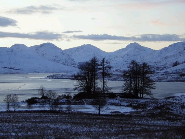
Loch Ard, Stirlingshire, Scotland, December 2009
Today’s Top Weather Stories
On Weather & Climate Through the Eyes of Mark Vogan
TOP STORY
AccuWeather.com Winter Forecast for 2010-2011
AccuWeather News
Winter to slam Northwest as South stays warm and dry
USA Today
Tropical Cyclone Giri (4B) Targeting Western Myanmar
AccuWeather News
SNOWY OCTOBER IN GREAT BRITAIN
Snow falls in Yorkshire – In October!
The Daily Telegraph
First blast of winter brings snow to north of Scotland
The Daily Record
LATEST NEWS ON TYPHOON MEGI
Typhoon weakens ahead of landfall in south China
USA Today
China braces for Typhoon Megi
CNN
Today’s Weather across America
From AccuWeather
Chilly and Damp in the Northeast
By Katie Storbeck, Meteorologist
Richard May Cause Trouble in Florida, Gulf of Mexico
By Alex Sosnowski, Expert Senior Meteorologist
Postseason Baseball Could Have its First Delay
By Gina Cherundolo, AccuWeather.com Staff Writer
Powerful Thunderstorms to Menace Lubbock, Oklahoma City
By Katie Storbeck, Meteorologist
Weather Talk
By Mark Vogan
REMEMBERING THE LONDON SNOW AND NATIONWIDE COLD OF OCTOBER 2009, DOES OCTOBER 2010 COMPARE?
When looking at this October’s cold and hill snow, I thought it would be good to look back at the cold and snowy October of only 2 years ago.
London of course made all the headlines during that Arctic Outbreak as the city recieved it’s first October snowfall in 74 years. Temperatures outwith the urban core dropped easily below freezing and indeed the cold spot was Benson, Oxfordshire where the low dropped to -4C/24F.
Now though we’ve seen snow and plenty of it at that over the north with parts of Perthshire, Aberdeenshire, Moray and Invernessshire as well as over the Pennines of England, this actually doesn’t grab as much attention as the London 2008 snow, simply because of the fact that London is far to the south in the UK where milder air typically is and remains there later into the autumn than farther north, therefore this makes it more unusual to start with, however, recent years (20 to 30 years) of milder winters, likely due to a warm North Atlantic, snow has actually become rare at anytime of the year, especially for the central and southern portion of England. So, accummulating snow is already tough to get in London.. but to have it at a time that’s basically unusual for many and not just southern Britain in October makes this event more interesting.
The stat of “first October snow in 74 years for London” tops it off.
So, even with snow, lightening and lows down to -5C/23F across Scotland and even the higher terrain of central England, I don’t really think this current (or ending) Arctic Outbreak of 2010, though arriving early and bringing widespread frost and biting cold winds, has the edge on what we saw back in October 2008 where there was several very cold nights, snow in a more widespread scale and indeed the historic city of London sow which accummulated to a few inches in the suburbs.
What I am interested in however is that during later that winter, in February, heavy, crippling snow basically shut down London and the south of England with 4-6 inches in Central London and 1-2 feet outwith…
By linking October snow and cold (despite not reaching London this year), could this tell us of a nasty winter across the southern of UK this winter ahead?
Join me, October 31st, right here for my winter forecast!
Article on that infamous snow in London on Oct 29, 2008
Vagaries of the Weather
India & Sub-Continental Asia Weather
By Rajesh Kapadia
Thursday, October 21, 2010
Cyclone “Giri” is now located 450 kms South of Chittagong, and has tracked NE. It is expected to hit land over Myanmar by tomorrow.
Now, this is due to our predicted W.D. diverting the cyclone eastwards and precipitating rainfall over Myanmar/Bangladesh.
The W.D. mentioned in the previous blog is now over Kashmir, and is expected to remain active with precipitation in Kashmir, H.P.and Utteranchal during the next 2 days.
Now, with the “running away” of this cyclone. I would finally look towards the NEM.
Meanwhile, we may now see the couple of UACs in the Konkan and interior Mah. regions move southwards, and drag the monsoon axis to where it should be. Vagaries predicts the withdrawal of the SWM and “ground preparations” for the NEM from Monday.
Interestingly, IMD forecasts a UAC in the T.N. coastal region by as early as Monday.
A strong wet phase of the MJO wave will be “allowed “to move in eastwards towards the South-Eastern coast of India (Tamil Nadu). This would subsequently displace the dry MJO in the region. Wet phase of the MJO are known to set up monsoon onsets, low-pressure areas and depressions.
Easterly waves would result in major amounts of accumulated rainfall in interior T. N, Coastal T.N and and Kerala during next week.
See our Partner’s Full Blog Here for not only great India and Asian Weather News but International Weather and more.
What’s Reaching Today’s Blogs?
Joe Lundburg, AccuWeather
Henry Margusity, AccuWeather
The Extremes of the Day
Today’s US Extremes
Courtesy of AccuWeather
High: 92 degrees at Laredo, TX
Low: 16 degrees at West Yellowstone, WY
Today’s UK Extremes
Courtesy of the UK Met Office
High: 57 degrees at Killowen (Co Down)
Coolest High: 41 degrees at Loch Glascarnoch (Highland)
Low: 23 degrees at Hurn (Dorset)
Today’s Extremes here at my house
High: 50 degrees
Low: 36 degrees
Thanks for reading.
-Mark


Recent Comments